Saturday, October 12, 2013

Our Last Hike

Friday, October 11th
Day Off #3

The nasty weather system that brought wet, chilly weather for the past two days has moved out and today was perfect for hiking--clear skies. plenty of sunshine, a light breeze and temperatures in the mid-60s.  We wanted to investigate caves near the Best Friends entrance because we heard they contain green, blue and orange sand as well as a  mountain lion painted on the wall for a movie.  However, at the access point we  spotted two men setting posts for a fence to bar visitors.

On to Plan B:  hike Tiny Canyon to Mace Cave.  Earlier in the summer we attempted to find this cave, reputed to contain petroglyphs, pictograms and metates, but lost our map while climbing to the plateau and felt uncomfortable continuing without it.  Today we had a topo map loaded on the GPS and aerial photos from Google Earth.  Despite these aids, we again failed to locate the cave.  While traversing the plateau we noticed several places where there were numerous pottery sherds laying on top of the sand.  Mixed among the broken pieces were chunks, chips and flakes of chert, the agatized petrified wood Indians often used for stone points.  Chert isn't native to the plateau and we only found it in conjunction with the pottery pieces. 

The White Cliffs from the plateau above Tiny Canyon
 

An overhang, not a cave
 

Pottery and chert 

In the excitement of finding the pottery and chert, I told Fred, 'Wouldn't it be a fitting end to the summer if we found a perfect arrowhead?'  Not ten minutes later, he called me over and showed me this:

Half-inch long arrowhead
 
 
So, wish granted:  the perfect ending to what's been a perfect summer.

Thursday, October 10, 2013

Counting Down

Friday, October 10

The five and half months we've spent here have sped by so quickly that it's hard to believe departure is only four days.  Nevertheless,  conditions have changed rather dramatically during the past ten days:  the weather has turned chilly two weeks earlier than normal, according to the locals; trees are donning their fall wardrobes; tourist traffic has shifted from American families to French and Chinese bus tours; and the parks are closed.

We spent part of yesterday, the first of our three days off this week, preparing the RV for the long trip back to North Carolina.  After completing our list of chores, we were anxious to get away from the RV park for a while.  However, a forecast that included the possibility of thunderstorms steered us away from hiking and we decided to video the drive through Zion with Fred's GoPro camera.  Conditions were nearly perfect for that project--a dramatic cloud-filled sky, colorful foliage and very little traffic on Route 9.  (Rangers at both the East and South entrances instructed drivers not to stop and turned away vehicles too large to travel through the tunnels.)

Fred has posted the video of our trip through Zion from the East gate to Springdale at http://youtu.be/8p-14EJQ4bU

Friday, October 4, 2013

Slithering in Slots

Friday, October 4
Days Off #1 & 2
 
The long trip back to NC will begin on Monday, October 14th so we'll use next week's days off to prepare for departure.  That meant this Wednesday and Thursday would be the final opportunity to whittle down our wish list. 
 
Escalante was our destination and we drove the back way, Skutumpah Road from Johnson Canyon to Cannonville.   On the way, we took a leisurely hike down Lick Wash, stopping to take pictures and exploring side canyons or anything else that looked interesting.   About half a mile down the wash, we met a couple who stayed at Parry Lodge last week and enjoyed hearing what they'd done since leaving Kanab. 


Past Twisted Pine Arch and Lost Spire Hoodoo, we located the 'Slitheryn Slot,' a short but extremely narrow little canyon.  One spot was so constricted that my foot became wedged between the right and left walls--I had to pull my foot out of the shoe in order to get free.  On the way back to the trailhead we  encountered several groups of inexperienced hikers.  Our guess was they were at Lick Wash because the national parks and monuments were closed.


The plan for the next day called for an early start to Phipps Arch, descending the slickrock slopes from Highway 12.  But after a fitful night's sleep in a poorly-maintained motel that plan seemed too ambitious so we moved to the next item on the list:  finishing our exploration of Diana's Throne Canyon. 
 
Traveling the paved highways, we noted that Cannonville, Tropic and the businesses outside Bryce were very quiet.  Four tour busses had pulled into the Red Canyon visitor center and the dazed passengers milled around the parking lot.  Sad.

A few miles north of the RV park, we took off cross-country for Diana's Throne Canyon.  (Because we don't rappel or use ropes, we've had to tackle it in three segments,  bottom-up instead of top-down.)  This final section is longer, tougher and more varied than the two upper parts we'd investigated previously.  At a particularly difficult spot, we ran into a local guide who was training a couple how to descend the narrow chute.  Watching their technique helped us figure out a way to ascend.  Despite the scrapes and bruises, we love the challenge of getting into and out of  special places few others have seen.


It has gotten cold:  today's high will be in the upper 50s and the  temperature will go below freezing tonight.  We had breakfast at the lodge and worked around the RV for most of the day.  Tonight is Kanab High School's homecoming game--we may go to see Chad and Haden play...if it's not too cold.


Tuesday, October 1, 2013

The Cherry on Top!

Sunday, September 29

This summer has been wonderful and we've enjoyed an interesting job, friendly co-workers, (generally) appreciative customers, great hikes, (mostly) beautiful weather, a RV site with full amenities, a quirky, fun little town in the center of some of the world's most stunning landscapes and a variety of special events to attend.  All left to wish for was sharing some of this bounty with friends.  That opportunity came with the arrival of Linda and Mike, our friends/neighbors from North Carolina.   They  arrived on Friday (Sept. 21) and we finalized plans for hiking The Wave over dinner at a Mexican restaurant.

Linda, Mike and Jan on the trail to The Wave

We reached Wire Pass trailhead just an hour after an early Saturday morning breakfast at Parry Lodge due to the excellent condition of House Rock Valley Road.  The temperature was chilly, the sky was mostly clear though a few dark clouds occasionally peeked from behind the Cockscomb as we set out.  By the time we reached the contorted U forming the entrance to The Wave, the wind had increased significantly and hurled grains of sand at us.  I took off my sunglasses at exactly the right moment to receive an eyeful!  Linda, Mike and Fred explored further while I struggled to extract the sand from behind my contacts.  Fred patiently led me, shrouded like a weird mummy,  2.5 miles over slickrock and through deep sand to the parking lot and drove us back to the RV.   This would have been a disappointing conclusion to our years-long quest for a permit for The Wave... if we didn't have a second permit for Saturday! 


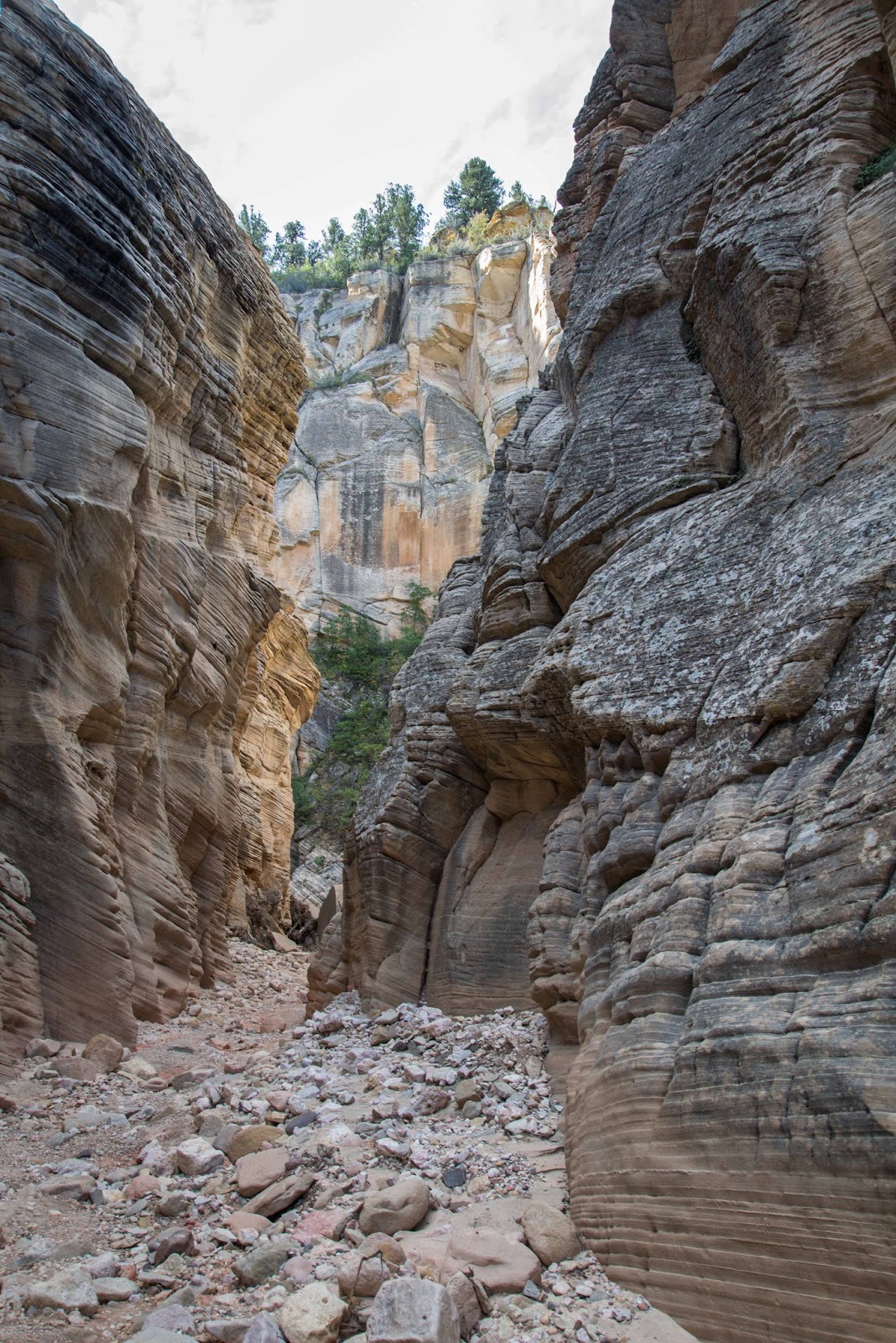
We met Mike and Linda in Springdale on Thursday to hike the middle fork of Taylor's Creek in the Kolob Canyon section of Zion.  The trail is an easy meander on the floor of a lovely valley following--and frequently crossing--a pretty little stream.  Recent storms channeled a tremendous volume of water into the creek, damaging the trail and necessitating scrambling around some obstacles.

On a stretch of smooth, damp sand we found fresh mountain lion tracks.  'Reading' them, we learned: #1.  he was quite large and #2. he was traveling the same direction we were.  Shortly after that discovery we caught up with a couple ahead of us and encountered more people on the trail--i.e., additional meal choices for a hungry predator.

We headed back to the trailhead after a picnic at Double Arch Alcove, the end of the official trail, and a photo-op for Fred and Mike to 'shoot' the vibrant, glowing rocks. 

Double Arch Alcove


The view from the interior Double Arch Alcove

In the parking lot at the top of the scenic drive, I realized I'd lost my camera.  Fred and I returned to Taylor's Creek and re-hiked the last half of our route without luck.  On the way to inquire at the visitor center, Mike waved us down to report a camera had been turned in.  I described the case and camera well enough to convince the ranger that I was its owner.  Next stop:  a great ice cream shop in Springdale to celebrate a satisfying day of hiking!

Saturday graced us with weather perfect for The Wave--a cloudless, intensely blue sky, pleasant temperatures and a gentle breeze--and so few other hikers that we felt we had the entire wondrous place to ourselves.  Thanks to Mike and Linda's previous visits, they were able to guide our exploration to take advantage of the best light for pictures.
The only way to react to The Wave is WOW!!!  Words cannot convey the indescribable beauty and uniqueness of this place so we'll let our pictures speak for themselves--with the caveat that pictures can not do it justice:


 Ephemeral pools were a surprise and the colonies of tadpole shrimp they contained were intriguing!
 

Friday, September 20, 2013

Off the Beaten Track

Friday, September 20

With very sketchy directions, we bush-whacked cross-country to Diana's Throne Canyon hoping to explore its slotty sections. A number of spots required ropes we don't have and down-climbs we don't know how to do so we hiked to the rim in order to skirt obstacles and then made our way down into the canyon below them.  In tackling the canyon this manner, we increased both the mileage and difficulty of the hike but found some really unique places we would have missed otherwise.

First Downclimb

Hidden Chamber
 
View in Slot

 Trail to Canyon

Second Downclimb


Soup Town is a cute little place that serves delicious soup and sandwiches in Orderville, just a few miles from Diana's Throne on Route 89.  It was on our way to Joe's Rock Shop so we had lunch there for the third time.  At Joe's, we bought some cool rocks, one of our weaknesses, and asked about septarian nodules.  He gave us directions to the site where he mines them and said we were welcome to look for some on our own.  
 
Septarians formed between 50 to 70 million years ago. As a result of volcanic eruptions, dead sea life was chemically attracted to the sediment around them, forming mud balls. As the ocean receded, the balls dried and cracked. Due to their bentonite content they also shrank in size, creating the cracks inside. As decomposed shells seeped down into the cracks in the mud balls, calcite crystals formed. The outer thin walls of calcite then transformed into aragonite. The name Septarian comes from the Latin word "septem", meaning seven, because the mud balls had a tendency to crack in 7 points in every direction, thereby creating the distinctive pattern these nodules exhibit. Septarians are composed of calcite (the yellow centers) and aragonite (the brown lines) enclosed in an outer grey layer of limestone.
 
The operation is located in one of the few non-lovely places in Utah--grayish-tan soil and rocks interspersed with sparse, scrubby, gray vegetation.  The nodules tumble down into a wash after the heavy equipment digs into the hillsides.  There was no shade and the wash was very deep and we were tired from all the climbing up and down we'd done in morning.  We settled for scouting the base of the tailings pile because anything we found in the wash would have to be carried out of the wash.  Without much searching we found two interesting broken nodules and were satisfied with this limited success.
 

 Septarian Nodules Mining Site

Tuesday, September 17, 2013

Rock Slab Cabin with Petroglyphs

Today Jan had to work and I didn't so I set off to explore a small side canyon to Kanab Creek a couple of miles up the road from our RV site. We were told when we first arrived that there were petroglyphs a small distance up the canyon but we were unsuccessful in our attempt to find them.

Within 20 minutes of hiking I had crossed the deep and steep-sided wash and reached the end of the canyon. Here I found a panel of petroglyphs that are a different style from most of the ones we have found elsewhere.

End of Side Canyon
 
Panel of Petroglyphs
 
Unexpectedly, I also found a small cabin that was made from three large rock slabs with a tin roof and wooden side wall. The entrance was a small crevice between the rock slabs.  The interior firepit with bucket and miscellaneous items indicated that someone had been living or camping there.
 
Cabin Entrance

Cabin

 
Cabin Interior
 
The round trip hike was a little over a mile and took 40 minutes with a double descent and ascent of approximately a 50-60 ft deep sand wash.

Saturday, September 14, 2013

A Drive Through Hildale

September 13th

Hildale is the Utah branch of the polygamist community of Short Creek.  Its Arizona component, Colorado City, is better known because it was (is?) the fiefdom of Fundamentalist LDS leader Warren Jeffs.

Many of the houses are very large:


Many are incomplete or not well maintained:


Most are behind high walls: