Friday, May 31, 2013

Serendipity

Wednesday, May 29th
Day Off #3

We intended to hike in Zion to Two Pine Tree Arch and then on to Progeny Peak using social trails described on-line.  When we pulled into the parking lot in the vicinity of the trailhead, it was occupied by two young men of unkempt appearance and their battered minivan.  Not completely certain that this was the spot mentioned in the write-up and a bit reluctant to leave the Jeep unattended, we moved to the next pull-over and entered the wash north of the road to explore some other trails. 

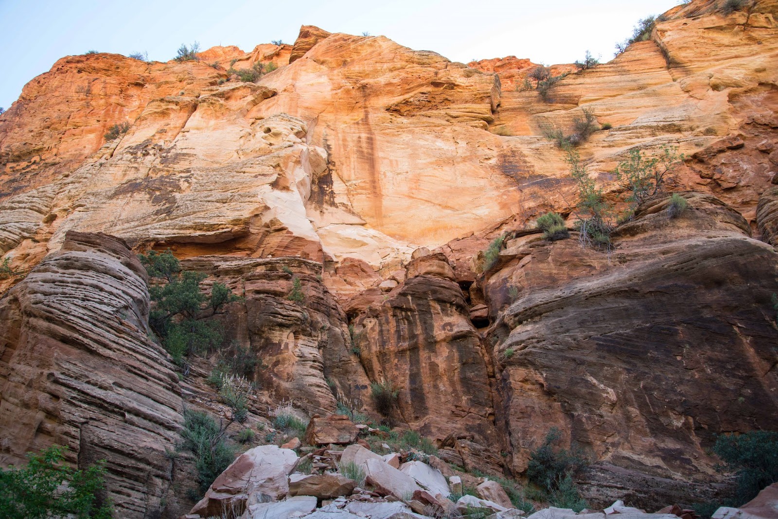
We walked about a mile in Pine Creek Wash, enthralled by the rich, glowing colors of the rock above us as gentle morning sunlight crept into the canyon.  Reaching a major rockfall, we decided to turn around (even though ascending it looked within our abilities) because we didn't know what lay beyond.  We crossed under the road via a rock tunnel to enter Clear Creek Wash on the other side.  It was less colorful than Pine Creek but more interesting due to its narrow and serpentine slot sections.  Once again we found ourselves wading through deep sand, rock-hopping and scrabbling over boulders, traveling about a mile and a half while roughly parallel to Route 9.


Several tiny but fearless hummingbirds have laid claim to our site.  Two flew up to inspect me when I came out of the RV yesterday afternoon.  One hovered about six inches from my nose in order to let me know who's really in charge.  He then moved to investigate the tail light; I suspect its red color attracted his attention.

Our neighbor Deb told us she'd found a rattlesnake on her concrete patio earlier in the day.  A volunteer from Best Friends was dispatched to relocate the reptile but was unable to find him.

Tuesday, May 28, 2013

'Great Mountain Bike Ride'--Not!!

Tuesday, May 28th
Day Off #2

An on-line write up of the Joy Jordan Woodhill Trail praises it as 'one of the five best mountain bike trails in Utah!'  Even though it is in Arizona...

With such a glowing recommendation, we had to try the trail and put riding it on the calendar for this morning, following breakfast at the Parry Lodge.  The loop begins with a 1.75 mile slog up a gently inclined gravel road to the Clamshell, a distinctive boulder that projects over a slab inscribed with petroglyphs.  In spite of very sketchy directions we found it and saw not only the ancient markings but a panoramic view of the Chocolate and Vermilion Cliffs and the Kaibab Plateau sweeping away toward the Grand Canyon.  At this point the gravel ends (yay!) and the sand and moguls and hills begin (boo!).  A mile of this plus the bountiful breakfast in addition to tired quads from yesterday's scrambling in the dunes led us to cut the ride short and return to the Jeep.  If this Arizona trail is one of the top rides in Utah--YOU decide what that means!


The Chocolate Cliffs in the foreground with the Vermilion towering behind.
 
 
The Clamshell is in the center at the top of the cliff, quite a climb from the trail.
 

Ancient petroglyphs and modern (top center)
 

Some of the symbols and the style used to execute them were new to us.


 Inside The Clamshell


Can you find Leonard the Lizard?
(Bet you didn't know all lizards are named Leonard!)


Paw Hole

Monday, May 27th
Memorial Day
Day Off #1

Fred talked me into trying again for a Wave permit.  At this point, I am willing to forego seeing The Wave in return for not enduring the depressing and upsetting experience of the lottery.  Adding to the unpleasantness of not securing a permit were the BLM staffers assigned to help visitors:  One was sarcastic and purposefully obtuse while the other was either uninformed or reluctant to provide requested information. Definitely not like the friendly, helpful folks at the Pisgah National Forest Visitor Center...

 
Lottery officials operating their state-of-the-art selection equipment
(a Bingo set)
 

As an alternative, we purchased a permit for the Paw Hole in the Coyote Buttes South area of the Grand Staircase-Escalante National Monument.  (I have no idea if Paw Hole refers to the appendage at the end of an animal's leg or the man who's married to Maw.) Whatever the name means, it belongs to a enchantingly strange and magically lovely place. 

Some have called the formations 'sandstone teepees' but that is an inadequate and, in my opinion, an inaccurate description.  They reminded me of the swirly tops of Dairy Queen ice cream cones!  We enjoyed discovering unearthly-colored and surreal-shaped rocks and the spaces around and between them.   Exploring the Paw Hole required walking in deep, powedery sand and climbing steep, high dunes-- exhausting but worth every ounce of exertion! As with everything worthwhile, getting there wasn't easy--40 miles east on Route 89 and then 20 on House Rock Valley (unpaved and rough) and the final leg on two-track through our nemesis, deep sand.  This time we and the Jeep were up to the task.