Wednesday, June 12, 2013

Down Memory Lane

Wednesday, June 12th

With two days off this week, we needed to stay close to home and chose the North Rim for our destination.  Having spent two summers on the Kaibab, there were places we wanted to see again--the DeMott Meadows, Marble Canyon, Bright Angel Point and the North Canyon trail--as well as to experience the North Rim as guests rather than workers.

Our first stop was Marble Canyon, a rocky peninsula jutting into the north-south portion of the Grand Canyon above the Cockscomb.  The view is astounding and it's infrequently visited so one is able to experience a sense of solitude, peace and timelessness.  Although weather.com's forecast didn't mention it, the wind was  formidable, lashing the plateau at about 30 mph; we had trouble staying on our feet several times.  The silver lining was the wind kept us cool enough to scramble out to the very tip of the peninsula where we'd never ventured before.  We made sure there are still plenty of fossils then found a protected spot for lunch before continuing into the park.

 
The Cockscomb (those 'humps' across the middle of the picture) as seen
from Marble Canyon


We made the obligatory walk to Bright Angel Point; checked into our small, dark, uncomfortable cabin; took the trail from the Lodge along Transcept Canyon to the campground; checked out the camper store, gift shop and post office. We recognized a couple who had worked with us in 2007 but saw no other  familiar faces. Then we briefly  attended the ranger program on the patio of the lodge until we achieved the condition of  'medium-well' and had to move indoors.


On the way to Bright Angel Point

By then it was time for 'dinner on the edge.'  One of our traditions is dine on an ooey-gooey pizza from the Deli at one of the picnic tables along the rim of Roaring Spring Canyon.  I'm sure the ground squirrels enjoyed our meal just as much as we did!


After dinner the light for taking pictures from the viewpoints behind the lodge was better and we tried--when the Chinese tourists allowed us a spot at the railing. 


Fred told me the evening ranger program in the auditorium--Searching for Life in the Universe--was very interesting. (I hadn't had any coffee for about six hours at that point, and as soon as the lights went out, so did I).  We meandered outside to the patio for the Star Party but prospects looked dim given the thick cloud cover.  Although the amateur astronomers urged people to wait for clearing skies, we were too tired and retreated to the small, dark, uncomfortable cabin.

Telescopes for the Star Party
 

Since Fred hadn't slept well in the small, dark, uncomfortable and noisy cabin and we were both sunburned and a bit queasy (ooey-gooey pizza? 100% increase in elevation?) we opted out of the North Canyon hike in favor of an early return to Kanab and a necessary trip to the grocery store.  On the way off the mountain, we stopped at the Country Store, where we worked in 2010, but we didn't see the owners.


Thursday, June 6, 2013

Change of Pace

Tuesday, June 4th
Day Off #2

Starting in the 1930s, the Kanab area was the setting for many Western movies and TV shows; one of the most popular was the "Gunsmoke" series.  A set, in deteriorating condition, sits on private land in Johnson Canyon, east of town.  The southern portion of the road is paved for about 20 miles then turning to dirt or gravel where it bears northeast toward Cannonville and becomes Skutumpah Road. 

 
Remnants of the 'Gunsmoke' set


We took our bikes to the small parking lot for viewing the Gunsmoke set and rode north for 7.5 miles.  The road is flat, lightly traveled and surrounded by magnificent scenery:  gentle hills clothed in juniper and sagebrush, stark chalky-white cliffs, striking coral pink sand that glows neon in sunlight and, looming above all, Navajo sandstone heights.  Traveling the canyon  floor, we biked past homes, irrigated fields, grazing cattle and numerous side canyons. 

Although we enjoyed the ride and the scenery, we had several errands to complete and needed to turn around.  A headwind made getting back to the car a bit less fun.


First on our to-do list was returning to the Red Pueblo Museum in Fredonia in hopes the curator could give us some information about the pottery shards we'd found.  Mr. Dickson told us they were made by the Anasazi between 700 and 1250 AD.  The smooth pieces are probably older than the corrugated ones but the coarse non-corrugated shards are most likely Paiute, and therefore more recent.  Since there is an abundance of shards, it is likely there are arrowheads and perhaps beads present as well.  He was raised in the area and knows where to find secret and wonderful things-- dinosaur tracks, petroglyphs, pueblos, even an underground lake!  He'll be a valuable source of information and hiking destinations.


Smooth pottery shards 

 
Various styles of corrugated pottery


Corrugated pots


Monday, June 3, 2013

Lower Hackberry Canyon

Monday, June 3rd
Day Off #1

Two of our four workdays this week were short ones, 6 to 11 AM, but we were happy to see Monday arrive.  Our destination for today was Lower Hackberry Canyon in the southern part of the Grand Staircase-Escalante National Monument. 

We'd tried to hike here in the winter of 2012 but found walking on the ice-covered creek too risky.  Even though today was hot and the wash is sandy, it was an easier (and safer) trek than our earlier attempt.

Cottonwood Road, 36 miles east of Kanab on Route 89, is in good condition though a bit bumpy or washboard-y in a few spots.  On foot, travel up-canyon was plodding because of deep sand and, as time passed, increasing heat and decreasing shade.  About a mile and half from the trailhead, a trickle of water--Hackberry Creek!--started coming toward us and grew in volume the further upstream we went.  We took off our shoes and splashed through the cool, ankle-deep water to the turn-around point, barbed wire strung across the creek from one wall of the canyon to the other. 


The creek hadn't flowed as far down-canyon as we hoped and all too soon we had to get re-shod and trudge through the soft sand again.  I was soon grateful for the shoes because we came upon a rattlesnake sunning on a flat rock in the dry creek-bed.  He was as surprised as we were, deftly disappearing between two rocks and warning us away with his rattling.


Reaching the trailhead about noon, we decided to postpone the short but demanding scramble  to Yellow Rock until we had our hiking poles and could get an earlier/cooler start.  Instead, we would 'do' the Paria Box since we had to pass the trailhead on the way back to Route 89.   When we got to the Paria River, we realized that the map and brief description we had were completely inadequate:  is the Box upstream or down?  how long is the hike?  how difficult is it? why isn't our insect spray protecting us from these voracious greenhead flies? 


Again we strategically revised our plans, delaying the Box until we had better information.  The brave BLM volunteer at the hot, dry, dusty, lonely Paria Contact Station recommended driving 5 miles on the Pareah Town Site Road (vs 12 miles on Cottonwood) and traveling through the Box from west to east.

By the time we returned to the RV, we were grateful some of our plans had to be rescheduled--Hackberry was enough for today!

Friday, May 31, 2013

Serendipity

Wednesday, May 29th
Day Off #3

We intended to hike in Zion to Two Pine Tree Arch and then on to Progeny Peak using social trails described on-line.  When we pulled into the parking lot in the vicinity of the trailhead, it was occupied by two young men of unkempt appearance and their battered minivan.  Not completely certain that this was the spot mentioned in the write-up and a bit reluctant to leave the Jeep unattended, we moved to the next pull-over and entered the wash north of the road to explore some other trails. 

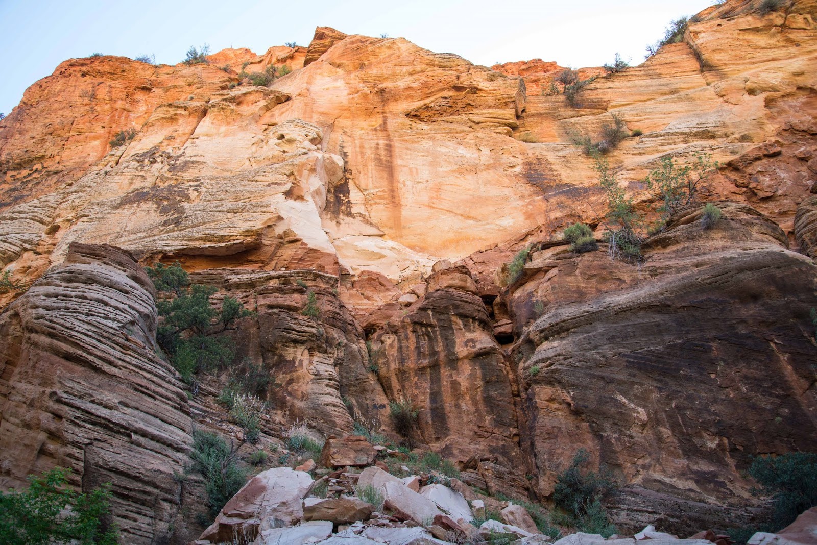
We walked about a mile in Pine Creek Wash, enthralled by the rich, glowing colors of the rock above us as gentle morning sunlight crept into the canyon.  Reaching a major rockfall, we decided to turn around (even though ascending it looked within our abilities) because we didn't know what lay beyond.  We crossed under the road via a rock tunnel to enter Clear Creek Wash on the other side.  It was less colorful than Pine Creek but more interesting due to its narrow and serpentine slot sections.  Once again we found ourselves wading through deep sand, rock-hopping and scrabbling over boulders, traveling about a mile and a half while roughly parallel to Route 9.


Several tiny but fearless hummingbirds have laid claim to our site.  Two flew up to inspect me when I came out of the RV yesterday afternoon.  One hovered about six inches from my nose in order to let me know who's really in charge.  He then moved to investigate the tail light; I suspect its red color attracted his attention.

Our neighbor Deb told us she'd found a rattlesnake on her concrete patio earlier in the day.  A volunteer from Best Friends was dispatched to relocate the reptile but was unable to find him.

Tuesday, May 28, 2013

'Great Mountain Bike Ride'--Not!!

Tuesday, May 28th
Day Off #2

An on-line write up of the Joy Jordan Woodhill Trail praises it as 'one of the five best mountain bike trails in Utah!'  Even though it is in Arizona...

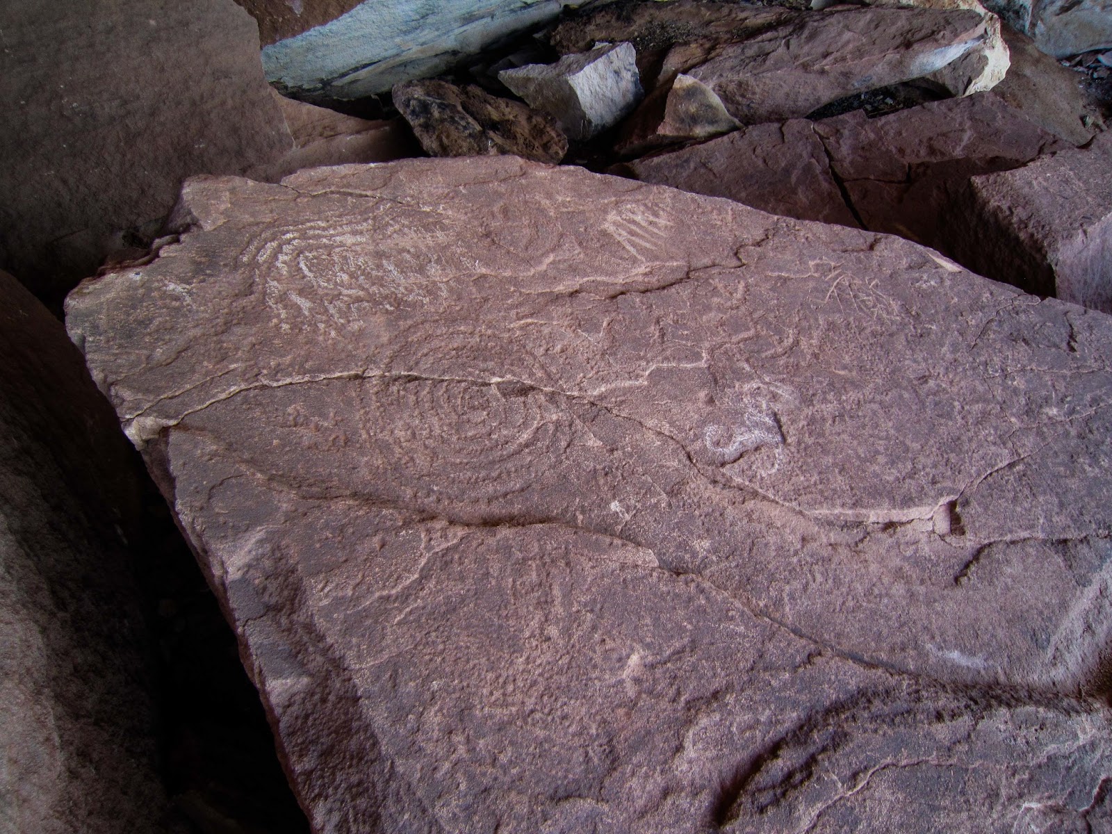
With such a glowing recommendation, we had to try the trail and put riding it on the calendar for this morning, following breakfast at the Parry Lodge.  The loop begins with a 1.75 mile slog up a gently inclined gravel road to the Clamshell, a distinctive boulder that projects over a slab inscribed with petroglyphs.  In spite of very sketchy directions we found it and saw not only the ancient markings but a panoramic view of the Chocolate and Vermilion Cliffs and the Kaibab Plateau sweeping away toward the Grand Canyon.  At this point the gravel ends (yay!) and the sand and moguls and hills begin (boo!).  A mile of this plus the bountiful breakfast in addition to tired quads from yesterday's scrambling in the dunes led us to cut the ride short and return to the Jeep.  If this Arizona trail is one of the top rides in Utah--YOU decide what that means!


The Chocolate Cliffs in the foreground with the Vermilion towering behind.
 
 
The Clamshell is in the center at the top of the cliff, quite a climb from the trail.
 

Ancient petroglyphs and modern (top center)
 

Some of the symbols and the style used to execute them were new to us.


 Inside The Clamshell


Can you find Leonard the Lizard?
(Bet you didn't know all lizards are named Leonard!)


Paw Hole

Monday, May 27th
Memorial Day
Day Off #1

Fred talked me into trying again for a Wave permit.  At this point, I am willing to forego seeing The Wave in return for not enduring the depressing and upsetting experience of the lottery.  Adding to the unpleasantness of not securing a permit were the BLM staffers assigned to help visitors:  One was sarcastic and purposefully obtuse while the other was either uninformed or reluctant to provide requested information. Definitely not like the friendly, helpful folks at the Pisgah National Forest Visitor Center...

 
Lottery officials operating their state-of-the-art selection equipment
(a Bingo set)
 

As an alternative, we purchased a permit for the Paw Hole in the Coyote Buttes South area of the Grand Staircase-Escalante National Monument.  (I have no idea if Paw Hole refers to the appendage at the end of an animal's leg or the man who's married to Maw.) Whatever the name means, it belongs to a enchantingly strange and magically lovely place. 

Some have called the formations 'sandstone teepees' but that is an inadequate and, in my opinion, an inaccurate description.  They reminded me of the swirly tops of Dairy Queen ice cream cones!  We enjoyed discovering unearthly-colored and surreal-shaped rocks and the spaces around and between them.   Exploring the Paw Hole required walking in deep, powedery sand and climbing steep, high dunes-- exhausting but worth every ounce of exertion! As with everything worthwhile, getting there wasn't easy--40 miles east on Route 89 and then 20 on House Rock Valley (unpaved and rough) and the final leg on two-track through our nemesis, deep sand.  This time we and the Jeep were up to the task.


Wednesday, May 22, 2013

Great Get-away!

Wednesday, May 22nd

A difficult day at work on Sunday, with several unusual and unpredicted situations arising almost simultaneously, convinced us we'd earned those four days off circled on our calendar.  On Monday, we slept in (past 5 AM!), packed our bags, locked the RV and drove to SunRiver, an active 55 and over community south of St. George, for a two night "Stay and Play".  The accommodations and amenities went far beyond what we expected: we were assigned to a 2-bedroom, 2-bath villa with a two-car garage, full kitchen, den, great room and laundry room.  We had access to the well-equipped community center which housed the fitness center, library, ballroom, computer lab, meeting rooms, craft facilities as well as indoor and outdoor pools and we received a credit at the restaurant on SunRiver's golf course.


Fun Sculptures Abound in Downtown St. George


Carousel in St. George's City Park
 

After settling in at the villa, we had dinner at an excellent Mexican restaurant we discovered during our 2012 winter sojourn in St. George.  Afterwards, Fred relaxed at the villa while I walked around for a closer look at the neighborhood and golf course.  On Tuesday we drove through the community, toured a number of model homes and spec houses, ate lunch at the on-site restaurant and wandered through the historic district of downtown St. George.  Late in the afternoon, Fred worked out in the weight room while I attended a Zumba class in the community center.   A trip to the nearby Walmart to stock up on nonperishables, a quick dinner and a little TV finished our day. 

We chose Route 9 through Zion for the return trip to Kanab in order to hike the Hidden Canyon trail we'd so enjoyed in 2011.  Either my body has gotten more fit (unlikely) or my memory has deteriorated (probable) because the hike today seemed appreciably easier, shorter and less scary than the first time we did it.  Setting out on the trail we soon encountered a group of 30 middle school students from Los Angeles who were on an extended field trip through canyon country as a reward for being the school's top seventh graders.  They planned to hike to Observation Point and explore Hidden Canyon on the way down.  We were quite flattered when a young person asked if we'd hiked the Angel's Landing Trail.  'Yes,' we replied proudly.  Her follow up question--'This morning?--' deflated us effectively.  Back at the trailhead, we took the short spur to Weeping Rock and were rewarded with lovely yellow columbine, shooting stars, pink penstemons and red monkey flowers.

 
That ledge is the trail to Hidden Canyon.
(Note the 'sissy chain' bolted to the wall.)


Arch Tucked Away in Hidden Canyon
 

Fred has posted video of the chain portion (i.e., the scary part) of the Hidden Canyon hike at  http://youtu.be/582ROFmuG2Y