Friday, May 31, 2013

Serendipity

Wednesday, May 29th
Day Off #3

We intended to hike in Zion to Two Pine Tree Arch and then on to Progeny Peak using social trails described on-line.  When we pulled into the parking lot in the vicinity of the trailhead, it was occupied by two young men of unkempt appearance and their battered minivan.  Not completely certain that this was the spot mentioned in the write-up and a bit reluctant to leave the Jeep unattended, we moved to the next pull-over and entered the wash north of the road to explore some other trails. 

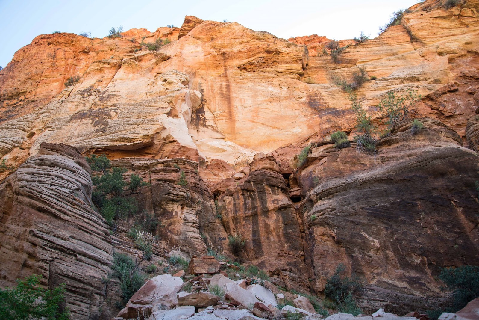
We walked about a mile in Pine Creek Wash, enthralled by the rich, glowing colors of the rock above us as gentle morning sunlight crept into the canyon.  Reaching a major rockfall, we decided to turn around (even though ascending it looked within our abilities) because we didn't know what lay beyond.  We crossed under the road via a rock tunnel to enter Clear Creek Wash on the other side.  It was less colorful than Pine Creek but more interesting due to its narrow and serpentine slot sections.  Once again we found ourselves wading through deep sand, rock-hopping and scrabbling over boulders, traveling about a mile and a half while roughly parallel to Route 9.


Several tiny but fearless hummingbirds have laid claim to our site.  Two flew up to inspect me when I came out of the RV yesterday afternoon.  One hovered about six inches from my nose in order to let me know who's really in charge.  He then moved to investigate the tail light; I suspect its red color attracted his attention.

Our neighbor Deb told us she'd found a rattlesnake on her concrete patio earlier in the day.  A volunteer from Best Friends was dispatched to relocate the reptile but was unable to find him.

Tuesday, May 28, 2013

'Great Mountain Bike Ride'--Not!!

Tuesday, May 28th
Day Off #2

An on-line write up of the Joy Jordan Woodhill Trail praises it as 'one of the five best mountain bike trails in Utah!'  Even though it is in Arizona...

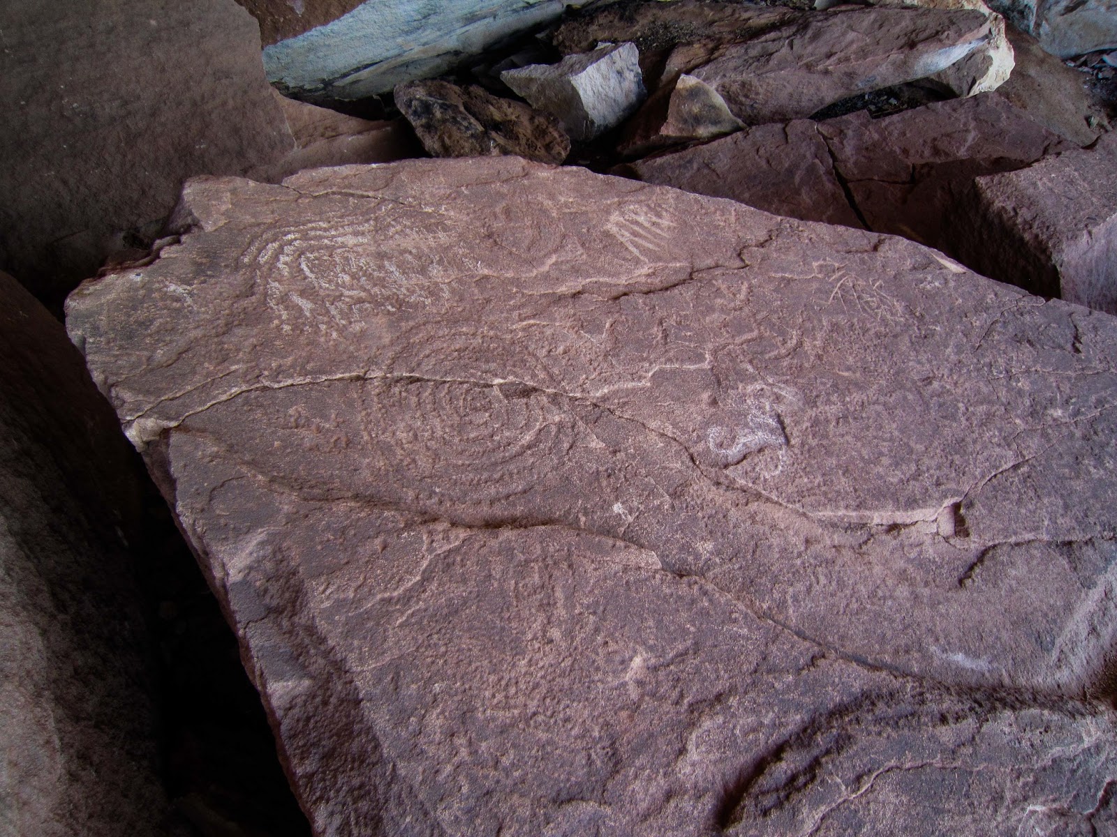
With such a glowing recommendation, we had to try the trail and put riding it on the calendar for this morning, following breakfast at the Parry Lodge.  The loop begins with a 1.75 mile slog up a gently inclined gravel road to the Clamshell, a distinctive boulder that projects over a slab inscribed with petroglyphs.  In spite of very sketchy directions we found it and saw not only the ancient markings but a panoramic view of the Chocolate and Vermilion Cliffs and the Kaibab Plateau sweeping away toward the Grand Canyon.  At this point the gravel ends (yay!) and the sand and moguls and hills begin (boo!).  A mile of this plus the bountiful breakfast in addition to tired quads from yesterday's scrambling in the dunes led us to cut the ride short and return to the Jeep.  If this Arizona trail is one of the top rides in Utah--YOU decide what that means!


The Chocolate Cliffs in the foreground with the Vermilion towering behind.
 
 
The Clamshell is in the center at the top of the cliff, quite a climb from the trail.
 

Ancient petroglyphs and modern (top center)
 

Some of the symbols and the style used to execute them were new to us.


 Inside The Clamshell


Can you find Leonard the Lizard?
(Bet you didn't know all lizards are named Leonard!)


Paw Hole

Monday, May 27th
Memorial Day
Day Off #1

Fred talked me into trying again for a Wave permit.  At this point, I am willing to forego seeing The Wave in return for not enduring the depressing and upsetting experience of the lottery.  Adding to the unpleasantness of not securing a permit were the BLM staffers assigned to help visitors:  One was sarcastic and purposefully obtuse while the other was either uninformed or reluctant to provide requested information. Definitely not like the friendly, helpful folks at the Pisgah National Forest Visitor Center...

 
Lottery officials operating their state-of-the-art selection equipment
(a Bingo set)
 

As an alternative, we purchased a permit for the Paw Hole in the Coyote Buttes South area of the Grand Staircase-Escalante National Monument.  (I have no idea if Paw Hole refers to the appendage at the end of an animal's leg or the man who's married to Maw.) Whatever the name means, it belongs to a enchantingly strange and magically lovely place. 

Some have called the formations 'sandstone teepees' but that is an inadequate and, in my opinion, an inaccurate description.  They reminded me of the swirly tops of Dairy Queen ice cream cones!  We enjoyed discovering unearthly-colored and surreal-shaped rocks and the spaces around and between them.   Exploring the Paw Hole required walking in deep, powedery sand and climbing steep, high dunes-- exhausting but worth every ounce of exertion! As with everything worthwhile, getting there wasn't easy--40 miles east on Route 89 and then 20 on House Rock Valley (unpaved and rough) and the final leg on two-track through our nemesis, deep sand.  This time we and the Jeep were up to the task.


Wednesday, May 22, 2013

Great Get-away!

Wednesday, May 22nd

A difficult day at work on Sunday, with several unusual and unpredicted situations arising almost simultaneously, convinced us we'd earned those four days off circled on our calendar.  On Monday, we slept in (past 5 AM!), packed our bags, locked the RV and drove to SunRiver, an active 55 and over community south of St. George, for a two night "Stay and Play".  The accommodations and amenities went far beyond what we expected: we were assigned to a 2-bedroom, 2-bath villa with a two-car garage, full kitchen, den, great room and laundry room.  We had access to the well-equipped community center which housed the fitness center, library, ballroom, computer lab, meeting rooms, craft facilities as well as indoor and outdoor pools and we received a credit at the restaurant on SunRiver's golf course.


Fun Sculptures Abound in Downtown St. George


Carousel in St. George's City Park
 

After settling in at the villa, we had dinner at an excellent Mexican restaurant we discovered during our 2012 winter sojourn in St. George.  Afterwards, Fred relaxed at the villa while I walked around for a closer look at the neighborhood and golf course.  On Tuesday we drove through the community, toured a number of model homes and spec houses, ate lunch at the on-site restaurant and wandered through the historic district of downtown St. George.  Late in the afternoon, Fred worked out in the weight room while I attended a Zumba class in the community center.   A trip to the nearby Walmart to stock up on nonperishables, a quick dinner and a little TV finished our day. 

We chose Route 9 through Zion for the return trip to Kanab in order to hike the Hidden Canyon trail we'd so enjoyed in 2011.  Either my body has gotten more fit (unlikely) or my memory has deteriorated (probable) because the hike today seemed appreciably easier, shorter and less scary than the first time we did it.  Setting out on the trail we soon encountered a group of 30 middle school students from Los Angeles who were on an extended field trip through canyon country as a reward for being the school's top seventh graders.  They planned to hike to Observation Point and explore Hidden Canyon on the way down.  We were quite flattered when a young person asked if we'd hiked the Angel's Landing Trail.  'Yes,' we replied proudly.  Her follow up question--'This morning?--' deflated us effectively.  Back at the trailhead, we took the short spur to Weeping Rock and were rewarded with lovely yellow columbine, shooting stars, pink penstemons and red monkey flowers.

 
That ledge is the trail to Hidden Canyon.
(Note the 'sissy chain' bolted to the wall.)


Arch Tucked Away in Hidden Canyon
 

Fred has posted video of the chain portion (i.e., the scary part) of the Hidden Canyon hike at  http://youtu.be/582ROFmuG2Y

Thursday, May 16, 2013

Keepin' It Local

Thursday, May 16th
Day Off #3

We got our fill of driving yesterday so the opportunity to stay close to home today was quite appealing.  The cliffs creating the cove our RV park is nestled into have interested us since we arrived and today we determined to explore them.  After a bit of bush-whacking, we stumbled across a trail that led upward along the ledge.  A gentle climb brought us from the base to the first level and provided a view three miles down-canyon to Kanab.  We named it Morris Mesa and marked a spot from which ascending to the summit looks definitely possible.

After lunch we went to the Red Pueblo Museum in Fredonia, AZ, 7 miles east of Kanab.  What a treasure!  The guide, a gentleman about our age, was instrumental in founding and stocking the museum, which is an entirely volunteer operation; his narrative was knowledgeable, first-hand and fascinating.   The museum displays rare Anasazi artifacts discovered by locals; Navajo pottery and spectacular rugs and blankets; a few pieces of lovely Paiute bead work; and some historical relics.  On the grounds we were able to enter a replica of a dug-out house and an authentic sheep wagon, peep through the windows of a 1930s pioneer cabin and see an old well-digging contraption.


Wednesday, May 15, 2013

Finally Reached a Destination

Wednesday, May 15th
Day Off #2

After being thwarted by sand on two recent expeditions, we chose a route which wouldn't present that obstacle--Tuweep Road, running 61 miles from AZ 389 to the very edge of the Grand Canyon direcctly above Lava Falls on the Colorado River.  Having visited Toroweap twice, we took the Mt Trumbull spur to Nampaweap to see the Indian petroglyphs.  The locals nicknamed the place Billy Goat Canyon because of the many representations of big horn sheep dotting huge chunks of basalt that have toppled from above.  We drove 150 miles, with more than 2/3 of the distance on rough, rocky, rutted roads, in order to hike three miles.  The petroglyphs were plentiful and fun to discover.  We kept a watchful eye out for the rattlesnakes reported by many visitors. Fred was disappointed we saw no rattlers, just two non-poisonous gopher snakes.


Tuesday, May 14, 2013

Curses, Foiled Again!

Tuesday, May 14th
Day Off #1

Today was the first of three days off so we went to the BLM office for The Wave lottery.  With 39 applications for 10 slots, we and many others left without the elusive permit. 

OK, on to the next item on the agenda:  breakfast at Parry Lodge on Parry Lodge, thanks to the free passes included in our first paycheck.  The buffet was delicious and well-stocked even though we arrived barely before it was scheduled to close.

Just a few miles north of Kanab is an unpaved road leading to Indian petroglyphs and, farther out, dinosaur tracks.  Although the description stated a high-clearance 4WD vehicle is necessary, it didn't mention sand--very deep sand.   We were about 1.5 miles from the trail head when we began plowing through it rather than rolling over it. Wary of getting stuck again, we turned around and headed out.  It seems exploring the outback in this part of Utah really requires ATVs.

On the return trip to the RV we visited Moqui Cave, a large, deep alcove in the Vermilion Cliffs.  A secluded spot where local teenagers partied, the property was purchased by a Mormon couple in the 1950s.  They transformed it into an bar and dance hall and ran it for several decades.  During those years, Garth discovered and displayed Indian stone points, pottery, fossils, fluourescent minerals as well as his own metal sculptures and wood carvings.  Desiring to retire, he and his wife sold the cave to its present owners who operate it as a roadside museum and gift shop.

The balance of the day was spent just messing around.  Hopefully, plans for Day Off #2 tomorrow will be more successful.


North of Kanab, looking northwest toward Zion